
Walk a Clark County Street
A sound address search moves from geography to documents, then to dated occupancy evidence. Begin with the county property search, not a name guess. It can normalize a partial address and return the parcel used across other county systems. The map then shows nearby lots and government jurisdiction. Recorded deeds and liens add parties to specific instruments, while directories and newspapers can document who was listed there in an earlier year.
- Enter the house number and street in the Property Information Center. Save the parcel or tax account and situs address.
- Open MapsOnline, use Find Parcel, and inspect the selected lot, nearby parcels, districts, zoning, permits, taxes, and recorded-document links.
- Check jurisdiction before seeking permits. County Community Development handles unincorporated addresses, while an incorporated address goes to its city.
- Search the parcel, legal description, or known party in the Auditor Landmark index. Treat each name as a recorded party, not a current resident.
- For an older household, consult a dated Vancouver directory, voter list, newspaper, census, or museum collection. Record the volume, year, page, and exact address.
The chain is address to parcel, parcel to jurisdiction, parcel to recorded instrument, then dated publication to household listing. Each step answers a different question. That distinction makes the Clark County street directory useful without overstating what a public index says.
Clark County Street Search Fields
The Property Information Center, or PIC, is the main public starting point for a current address. It accepts a tax parcel, house number, full street address, or partial address. A partial search helps when punctuation, direction, or street type differs from the user's version. Public results link to property account details and related county resources, but the research did not confirm every owner or mailing field in an unauthenticated live card.
| Search field | Use | Record role |
|---|---|---|
| Tax parcel | Enter the county parcel or account ID | Bridge to GIS, tax, permit, and deed work |
| House number | Pair with a street name | Narrow a street to one site |
| Street address | Keep direction and street type | Return matching property accounts |
| Partial address | Remove uncertain pieces | Find spelling or format variants |
The official PIC search screen shows the address and parcel entry choices.
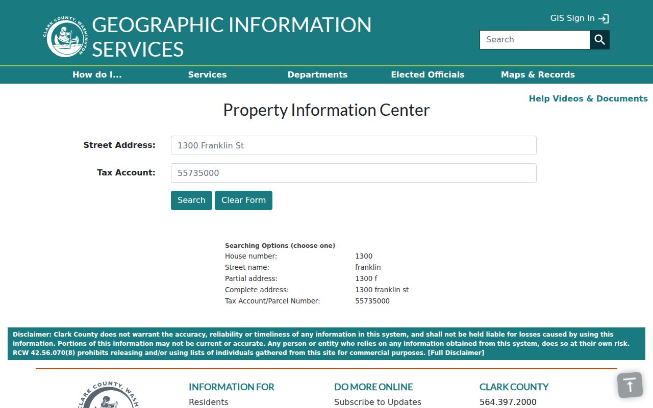
The screen confirms that Clark County street work can start with a house number, full street, or parcel without exposing a private household profile.
Clark County Records by Address
Clark County address records are spread among the Assessor, GIS, Auditor, Treasurer, Community Development, cities, and historical repositories. The table separates what each source supports. A parcel account describes property and jurisdiction. A deed index describes a filing. A permit file describes work tied to a site. None is a full list of people inside a building.
| Address source | Keeper | What it shows | Access |
|---|---|---|---|
| Property account | Assessor | Parcel, situs, value, districts, related tabs | PIC; Assessor request |
| Parcel map | County GIS | Lot shape, nearby parcels, layers, jurisdiction | MapsOnline and GIS store |
| Recorded instruments | Auditor | Parties, filing date, type, parcel or legal link | Landmark; office copies |
| Permits and plans | County or city | Existing permits, projects, plans, code files | Portal, email, phone, mail |
| Historic listings | Libraries, CCHM, CCGS | Name and address in a dated source | Reading room, film, catalog, request |
Landmark's online index begins January 1, 1961. Search modes include name, document, excise, book and page, parcel, date, filing number, and legal description. Online images are not certified, and purchase requires an account. Earlier material needs the Auditor Recording Office at 1300 Franklin Street, second floor, Vancouver, 564-397-2208, or recording@clark.wa.gov.
Note: A recorded party may be an owner, lender, trustee, spouse, estate, or business, so the document image controls the name's meaning.
Map Clark County Street Parcels
MapsOnline turns one address into a spatial check. Find Parcel accepts a tax account or street address. Identify and selection tools inspect one lot or a set drawn by point, line, polygon, rectangle, or radius. The official guide describes screens for assessment, zoning, districts, photos, environmental limits, taxes, recorded documents, permits, sales, and comparable sales. Owner-name, history, land-detail, and mailing-label functions may require employee or subscriber access.
The Clark County MapsOnline viewer provides the visual parcel route used after PIC.
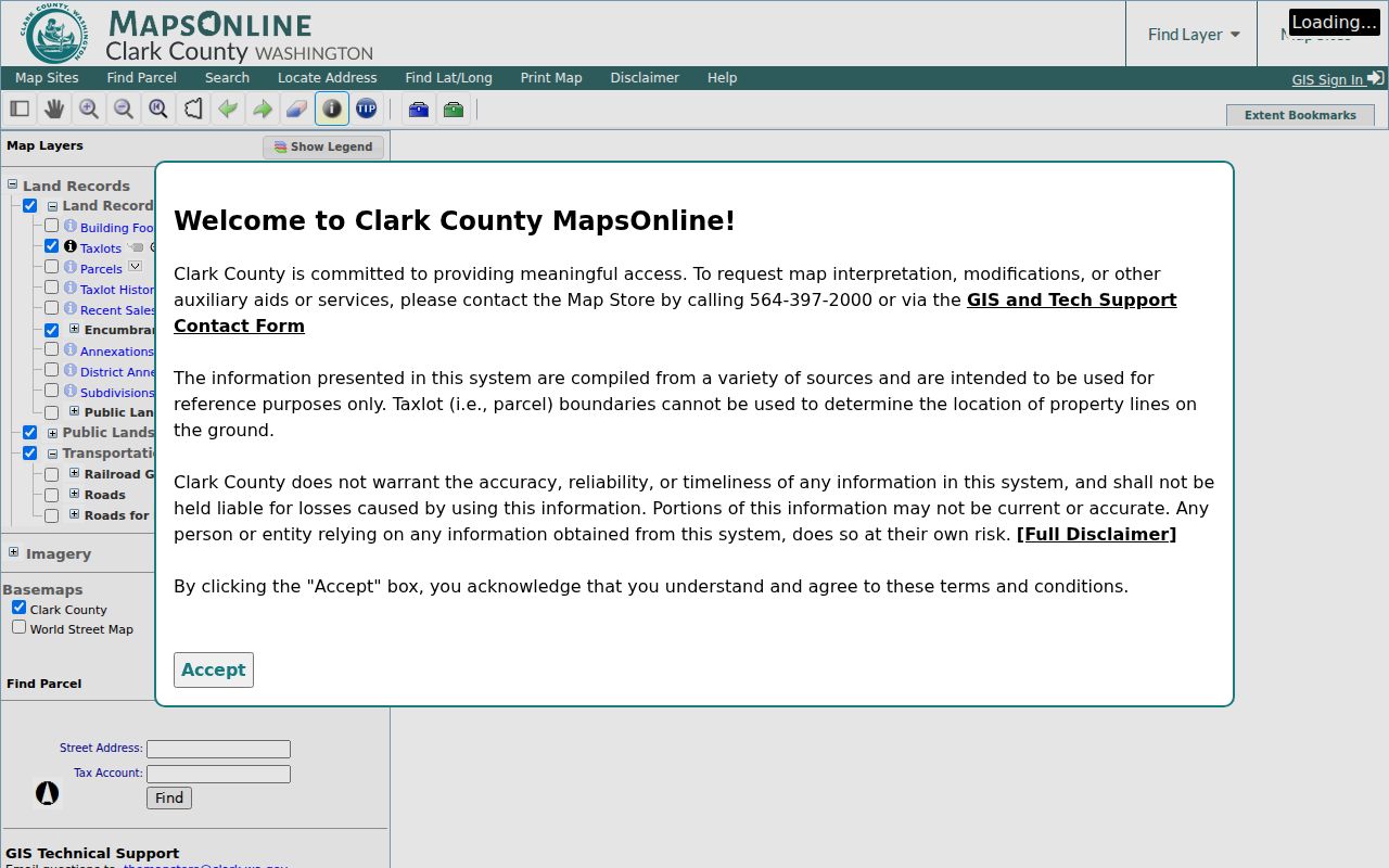
A saved map should include its title, layers, scale, selected parcel, and query date. That record distinguishes a parcel layer from a ZIP, jurisdiction, or neighborhood boundary.
Read the Clark County Grid
Clark County road guidance helps spot a mistyped address. Streets, ways, and circles generally run east to west. Avenues, places, and courts generally run north to south. Drives, loops, and roads may be diagonal or irregular. First Street and Division Street form reference baselines, while NE, NW, SE, and SW identify quadrants.
Even numbers generally lie north of streets and west of avenues. The first three address digits generally indicate a block, and the final two identify a house number. These are clues, not rules. Rural roads, private drives, old names, and new assignments may differ. Preserve quadrant and street type, then confirm the address in PIC and USPS.
- Parcel
- A mapped unit of land with a county identifier. One address may involve several parcels.
- Situs address
- The physical address used for a property account, which may differ from a mailing address.
- Plat
- A recorded map dividing land into lots, tracts, roads, or easements.
- Criss-cross directory
- A directory arranged by street and house number rather than only by surname.
Recorded Names Along Clark Streets
The Auditor index connects an address trail to legal filings. Search Landmark by parcel when the current account is known. If that does not return an older instrument, try a party name, legal description, book and page, or filing number. Results can include party name, document category, recording date, Auditor filing number, parcel ID, legal description, and an image link when available.
The Landmark official-record search displays the available modes for Clark County filings.
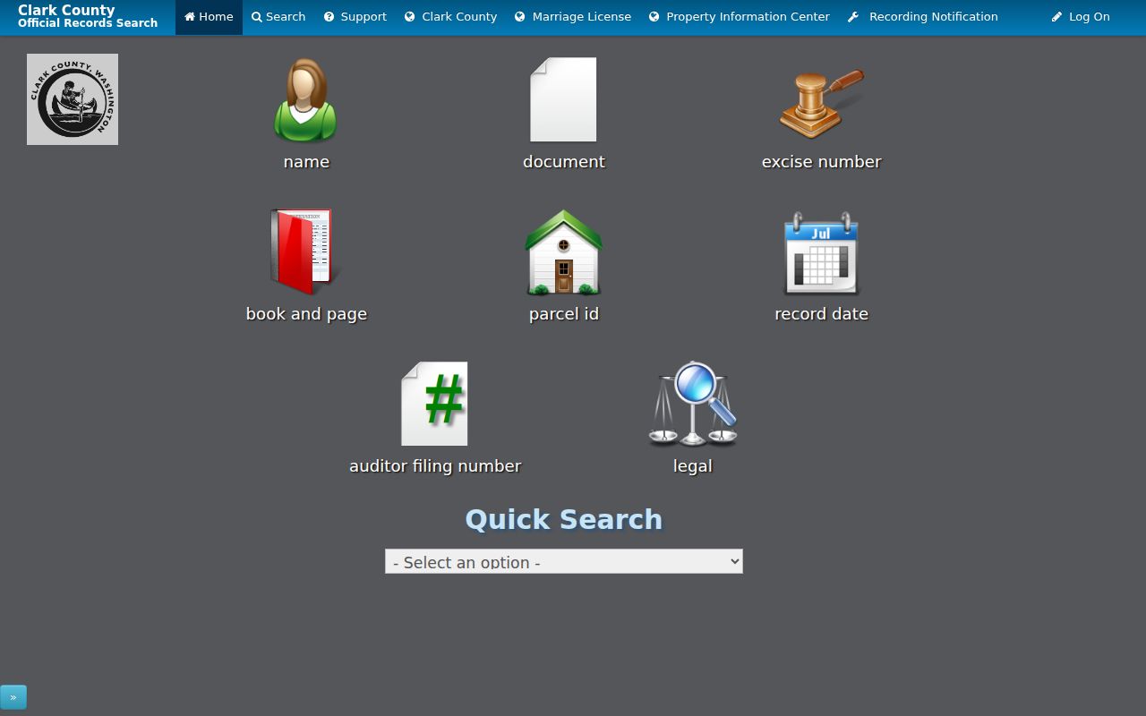
The screen is an index gateway. Certified copies come from the Auditor. For a title chain, read an instrument's prior reference, search that filing or book and page, extract earlier parties and legal description, then repeat. This traces recorded interests, not a resident list.
Clark County Permits by Street
Permits, site plans, and code files add dated facts about work at an address. First check jurisdiction in PIC or MapsOnline. The Community Development request route covers unincorporated Clark County. Include address, parcel, project or permit number, record type, and date range. Request through the county portal, email ComDevRecordRequests@clark.wa.gov, call 564-397-2375, or mail PO Box 9810, Vancouver, WA 98666-9810.
City-limit property goes to the relevant city planning, permit, code, or clerk office. A Vancouver mailing name does not settle custody. Under the Washington Public Records Act, an agency may clarify, estimate, produce in installments, redact, or deny. Inspection is free, while copies, media, postage, oversized plans, and large requests may cost money.
Clark County Address Boundaries
A postal city, ZIP polygon, neighborhood association, parcel jurisdiction, and city limit describe different boundaries. Confirm delivery ZIP through USPS ZIP Code Lookup. Use county GIS for parcel jurisdiction. The neighborhood directory identifies a community association, but it is not a roster of residents.
Annexation can change the custodian. Van Mall North took effect August 1, 2017, and the county Annexation Tracker can tie an annexation ID to affected parcels. A record made before that change may be held apart from a later permit. Save the parcel ID, USPS result, GIS jurisdiction, and annexation reference when routing a request.
Note: Never treat a mailing city or ZIP as proof that a Clark County street lies within the same incorporated city.
Historic Clark County Street Directories
Past occupancy calls for dated sources. Vancouver reading-room holdings include city directories from 1882 through 1996, mostly bound, with microfilm complete through 1929. Historical voter lists span 1886 through 1992, and news clippings cover 1860 through 2007 with title and year limits. A street section can place a listed householder at an address only in that publication year.
For those shelves, use the Clark County city directory collections. Record volume, year, page, printed spelling, nearby entries, and repository. Pair the entry with a same-era deed, census, map, newspaper, cemetery record, or photo. Absence in the next volume can mean a move, death, omission, or publication gap.
The 1890 Clark Records Gap
A courthouse fire on November 24, 1890 destroyed the second courthouse and virtually all county records from Clark County's establishment. A failed early address search therefore is not proof that no record existed. Later deeds may cite prior interests, while territorial or federal files, newspapers, churches, cemeteries, and private collections may preserve fragments.
The courthouse path runs from the territorial building opened in 1855, to the 1883 building, the 1890 fire, the 1892 replacement, and the fireproof courthouse completed in 1942. Landmark and GIS are only the newest stage. A Clark County street directory search before 1890 often needs several repositories and clear labels for catalog leads, transcriptions, and reviewed images.
Limits of Clark County Street Records
Public address systems do not create a complete current occupant list. A property account identifies land and account details. A deed names parties to an instrument. A historical directory is tied to its year. Voter information has statutory limits, and VoteWA is an identity-matched service rather than a street roster.
Keep each source label. Say recorded party for an Auditor result, parcel for GIS, registered voter only for Elections, and historical address listing for a directory. Add the search date and office. If a portal fails, use the counter, phone, email, mail, reading room, archive, or narrow public-record request instead of guessing.
Lawful use. Clark County address records are for lawful personal, historical, and civic research. Never use a street directory to stalk, harass, intimidate, or harm anyone.
A careful Clark County street directory shows what each record proves and leaves open. Verify a disputed filing with the Auditor, parcel detail with GIS, permit with the correct development office, and historic listing at its repository.