
Clark County ZIP Coverage Ledger
Official Clark County sources evidence the postal codes below in county tables or the GIS layer. They do not establish a permanent list of city assignments. Postal service areas change, and a single code may cross a city line. For a live mailing result, check the complete address in the USPS tool. For local record custody, compare that output with the county parcel and jurisdiction map.
| ZIP Code | Areas Covered | Post Office | Notes |
|---|---|---|---|
| 98601, 98604, 98606, 98607 | Clark County source coverage | Validate by full address | Exact service area not established in the cited county source |
| 98622, 98629, 98642 | Clark County source coverage | Validate by full address | Do not infer city limits from code |
| 98660, 98661, 98662, 98663 | Clark County source coverage | Validate by full address | Compare postal city with GIS jurisdiction |
| 98664, 98665, 98666, 98668 | Clark County source coverage | Validate by full address | Some codes may serve special mailing functions |
| 98671, 98674, 98675 | Clark County source coverage | Validate by full address | County evidence is not a boundary ruling |
| 98682, 98683, 98684 | Clark County source coverage | Validate by full address | Neighborhood and postal layers differ |
| 98685, 98686, 98687 | Clark County source coverage | Validate by full address | Check the current USPS assignment |
The list includes 24 codes found in official county research. It should be read as evidence, not as a claim that every code has the same kind of delivery area. The research did not locate a verified universal post-office or neighborhood assignment for each row. That gap is why the Clark County ZIP code directory keeps USPS validation separate from county GIS.
Clark County ZIP Map Check
The ClarkView ZIP polygon layer exposes a field named ZIPCODE. The service supports queries, labels, and statistics, with a maximum of 2,000 returned features. It is useful for county map context, but it does not replace postal confirmation. Save the query, layer name, selected polygon, and access date when a boundary matters.
The USPS ZIP Code Lookup is the postal companion. Enter the complete address to verify its current delivery code. County GIS answers where a mapped polygon sits; USPS answers how a particular address is routed for mail. A Census ZIP Code Tabulation Area, or ZCTA, serves statistical work and is a generalized approximation, not a live USPS boundary.
The county ZIP layer metadata shows the mapped field and service limits.
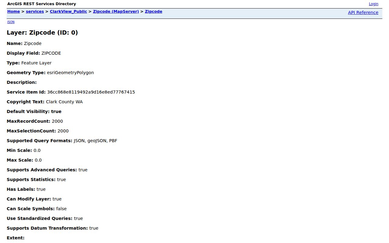
This source helps document county map geography while leaving postal validation to USPS.
Validate a Clark County ZIP
Use a full street address, including directional prefix, suffix, street type, and unit. Clark County roads often use quadrant labels such as NE, NW, SE, and SW. The county road grid generally treats streets, ways, and circles as east-west routes, while avenues, places, and courts tend to run north-south. Roads, loops, and drives can be irregular. Those patterns help catch a typing error, but the official tools still control.
The USPS lookup screen is assigned to this ZIP code directory as the postal check.
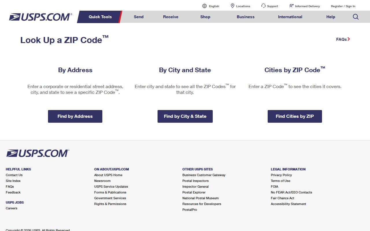
Copy the returned address and code exactly, then compare the parcel's jurisdiction rather than guessing from the mailing city.
Find Clark County Residents by ZIP
A ZIP narrows geography, but the official tools do not provide one open ZIP-wide roster of Clark County residents. Begin with a valid address or a defined record request. The Property Information Center accepts a parcel number, house number, or street address rather than a simple public ZIP-wide owner search. MapsOnline can show parcels and layers, but owner-name, history, and mailing-list tools may require employee or subscriber access.
- Validate the complete mailing address with USPS and retain the returned postal code.
- Open the county ZIP polygon layer, then use PIC or MapsOnline to identify the parcel and jurisdiction.
- Choose the record custodian. Use a city department for a city-limit file and the county route for an unincorporated file.
- If a lawful voter-data extract is needed, follow the Elections or Secretary of State request rules and keep the signed-use limits.
Once the postal area is narrowed, the Clark County street directory explains the address and parcel sequence in greater detail. Do not infer that every person linked to a parcel receives mail at its situs address. A situs address identifies the physical parcel, while a mailing address may point elsewhere.
Clark County ZIP Search Fields
Three official systems contribute different fields. None should be described as a shared database. Use the source that matches the question and keep its output label. A postal result, GIS polygon, and voter-file extract can all contain a five-digit code while describing very different things.
| Official tool | Search input | ZIP output or use |
|---|---|---|
| USPS ZIP Lookup | Complete delivery address | Current postal code for that address |
| Clark GIS ZIP layer | Polygon query or mapped selection | ZIPCODE map field and label |
| PIC / MapsOnline | Parcel, house number, or street address | Parcel context, mapped jurisdiction, and related layers |
| Voter-data request | Defined county or district file request | Public fields subject to RCW and permitted-use controls |
VoteWA itself asks an individual for first name, last name, date of birth, and recaptcha. It is an identity-matched voter service, not a ZIP code search. Public voter-file requests follow RCW 29A.08.710, and RCW 29A.08.740 bars specified solicitation uses.
Route Clark County ZIP Records
A Vancouver mailing label can sit inside or outside a city service boundary. The same is true for other place names in the county. Community Development's county records route covers unincorporated Clark County, while incorporated places keep their own permits, police files, and other municipal records. Check the parcel's jurisdiction field in PIC or MapsOnline before filing a request.
Under the Washington Public Records Act, RCW 42.56, the county public-records overview links to GovQA. Supply the address, postal code, parcel or PIN, mapped jurisdiction, record type, and date range. The five-business-day response may produce records, link to them, estimate time, seek clarification, or deny the request. A city file must go to that city's custodian.
Clark ZIP and Neighborhood Layers
Neighborhood associations use another set of boundaries. The Clark County Neighborhood Association Directory searches by address and opens an association boundary popup. It also routes city-limit addresses toward the city neighborhood program. Active or inactive association status does not reveal a roster of people, and county association lines are not postal lines.
Compare the address on both maps when community context matters. A parcel may share one postal area, a different association area, and another tax or city jurisdiction. This layered geography is a defining feature of the Clark County ZIP code directory. It prevents a postal code from being treated as proof that someone belongs to an association or lives within a municipality.
Historical Clark County Postal Clues
Historical directories are dated address evidence, not a map of today's postal zones. Vancouver genealogy resources cover city directories from 1882 through 1996, with books and microfilm providing names, addresses, and period roles. Older entries may predate modern ZIP codes or use an earlier road form. Preserve the printed address, volume year, and page before trying to normalize it.
The county road pattern can help interpret an older entry. First Street and Division Street serve as baselines, quadrant prefixes matter, and the first address digits generally point to the block. Yet annexation, road changes, and postal updates can alter later routing. Compare the old directory with a period map, then use current GIS only to describe present geography.
Clark ZIP Codes Versus City Limits
ZIP boundaries route mail. City limits assign municipal jurisdiction. Clark County GIS parcel data, the annexation layer, tax districts, and neighborhood maps can each draw different lines across the same postal area. Keep those layers separate in every search. For a record request, attach the validated address, code, parcel ID, GIS jurisdiction, and the agency that appears to hold the file.
- ZIP and ZIP+4
- A five-digit delivery area, with four extra digits that narrow the destination segment.
- PO-box ZIP
- A code used for post-office boxes rather than a general street delivery area.
- Unique ZIP
- A code assigned to one high-volume organization or institution.
- Carrier route
- A postal delivery path within a ZIP, not a city or parcel boundary.
No official source in the Clark County research verified a full list of box-only or unique codes. Confirm those labels through USPS before using them. The safe rule is simple: postal data routes mail, while the mapped jurisdiction routes the public-record question.